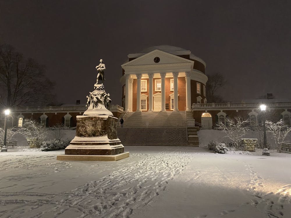
What has been a series of wintry weeks in Charlottesville looks to continue on Thursday as a mix of snow, sleet and freezing rain approaches the region. The National Weather Service has issued a Winter Storm Warning for snow accumulations between two to four inches, ice accumulations to around a quarter inch and sleet.
The University canceled daily prevalence testing for Thursday due to inclement weather and plans to reschedule students whose mandatory appointments were canceled.
A Winter Storm Warning is issued when a significant combination of winter weather is ongoing or imminent.
The wintry precipitation is expected to commence after midnight Wednesday as snow. By Thursday afternoon, precipitation is expected to change to sleet and freezing rain.
Snow that falls in the morning hours has the potential to be very heavy, with snowfall rates of one to two inches per hour resulting in extremely low visibility being possible.
There is significant uncertainty in this forecast, with computer models disagreeing on subtle but key aspects of the storm.
The difference between snow, sleet and freezing rain is dependent on subtle differences in air temperatures aloft.
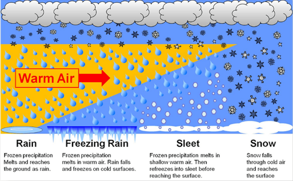
Snow falls when the atmospheric temperature is below freezing from the cloud down to the ground. Sleet falls when there is a thin warm nose in the atmosphere, causing the snow to temporarily melt before getting refrozen into an ice pellet while falling.
Freezing rain falls when the warm layer is deeper and the snowflake does not have time to refreeze into sleet by the time it hits the ground. When temperatures are below freezing, as they are expected to be tomorrow, the rain freezes up on impact and becomes ice.
Regardless of the exact totals of each precipitation type, the mix of snow, sleet and freezing rain is likely to result in fallen trees and power outages, resulting in “nearly impossible travel,” according to the National Weather Service
Temperatures during the storm will likely remain below freezing, allowing wintry precipitation to accumulate on roadways and sidewalks.
In a press release, the Virginia Department of Transportation warned of difficult and dangerous travel conditions on Thursday.
“Complete storm preparations today and plan to stay home during the storm,” VDOT advised. “Do not attempt to travel during this storm.”
In a tweet, U,Va. Emergency Management warned of significant snow, sleet and ice accumulations and urged people to prepare for the upcoming storm.
Any changes to the University’s operating status will be posted on the @UVA_EM Twitter account and on the Academic Operations Status Board.
Read More

Will SpaceX’s IPO affect the University’s endowment?
By Nicolas Biernacki | YesterdayThe University’s equity in SpaceX accounts for a “low single-digit percentage” of the endowment, per The Wall Street Journal.

Wahoo Commute program encourages sustainable transportation for U.Va. employees
By Charlotte Gabriel | YesterdayAs traffic and parking demand continues to increase around Grounds, the Department of Parking and Transportation's Wahoo Commute program provides cash incentives to University employees for walking, biking, using a scooter, using transit, vanpooling or carpooling.
Beardsley names committee to compose the University’s next strategic plan
By Lauren Seeliger | YesterdayThe July 13 media release lays out some early priorities Beardsley has for the planning process, a few of which include “faculty excellence, access and affordability … [and] world-class patient care.”